Satellite alerts can track small-scale deforestation
With data from satellites, there is generally a trade-off between resolution and the frequency of updates. This is the reason why most of the alerts already on Global Forest Watch, an interactive online forest monitoring and alert system designed to empower people everywhere with the information they need to better manage and conserve forest landscapes, are 500 or 250m resolution.
The GLAD Tree Cover Loss alerts are breaking this convention to give us the best of both worlds: the alerts are higher resolution and more frequently updated than other alerts. They are fine enough to detect loss from activities like logging, illegal mining and small-holder agriculture, all major drivers of deforestation that were previously too small-scale to be picked by alert systems on Global Forest Watch.
The alerts are also the closest to real time we have available: New alerts are triggered with every new, cloud-free Landsat image (as often as every eight days for any particular location) and are updated weekly on the website.
To learn more about the alerts read the full methodology paper, published in Environmental Research Letters.
Product Spotlight
APV1111GVY
Panasonic
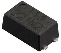
Panasonic PhotoMOS® Photovoltaic MOSFET High-Power Drivers
| SKU: | |
|---|---|
| Stock: | 3490 |
| Cost: | $3.95 |